Valongo
information
-
+351 224 227 900
This email address is being protected from spambots. You need JavaScript enabled to view it.
http://www.cm-valongo.pt/pages/618
41°10'53.6"N 8°28'29.4"W
-
Getting to the county of Valongo is easy. If you arrive at the airport Francisco Sá Carneiro or the port of Leixões (Matosinhos) you can, in these places, enter the Metro and go to Porto. Then, in the centre of this city, you just have to take a public transport that brings you to the municipality of Valongo. There are road lines to all the localities in the municipality. There are also regular transports between Matosinhos and the municipality of Valongo.
By train, in the Minho line, you can get off at Ermesinde station, and, in the Douro line, disembark in Valongo. You can also get off at the Palmilheira and Travagem stops, in Ermesinde, Cabeda in Alfena, Susão in Valongo and S. Martinho in Campo. Taking a taxi or renting a car can also be an alternative. If you come in your own vehicle by the coast, access through the A3, A4, or A41. If you come from the interior, access through the A4, A41 and A42. When you arrive in Valongo, take a seat in one of our hotels. Valongo and its people thank you for your visit!
-
Available soon...
location map
Services
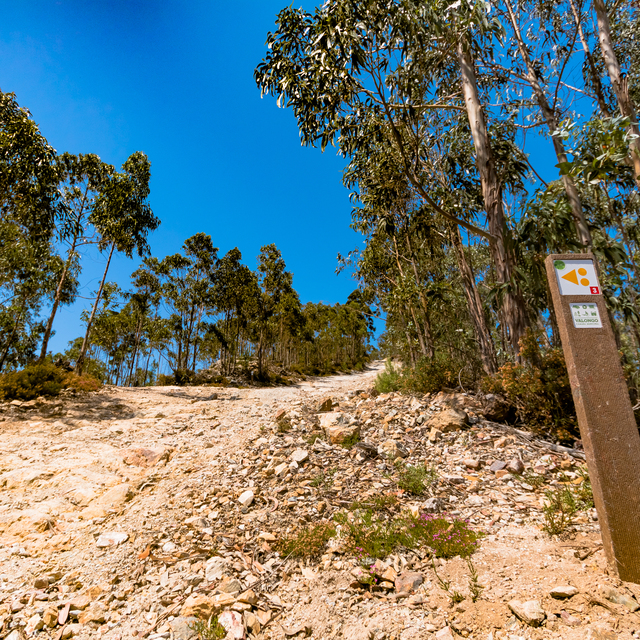
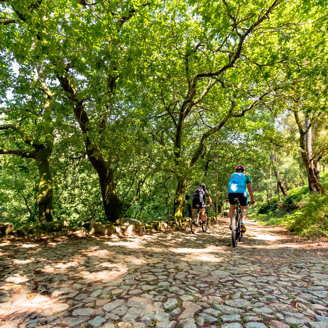
Map of Routes
Routes
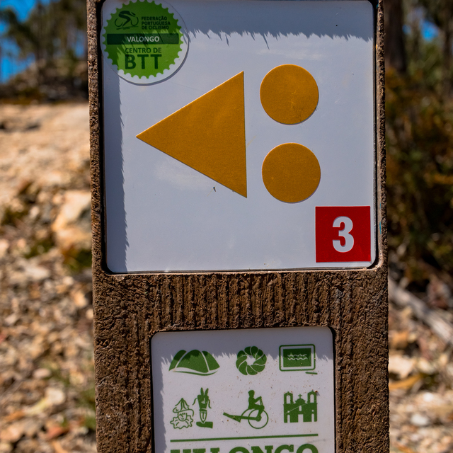
| p1 green |
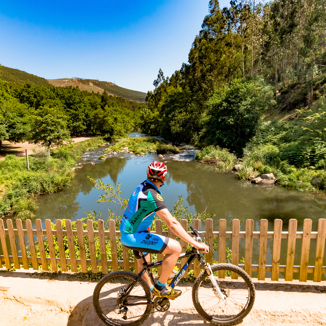
This course is intended for practitioners in initiation, without experience and with little physical resistance. The type of route for this type of user has to be rolling, with hard or asphalt floor and no obstacles, so the green route develops on the right bank of the Ferreira river, passing the village of Couce. Near the bridge of the river Ferreira in Couce, it continues on the right bank of the river until it reaches the stone (Marco) which mentions the area of the Paleological Park. The route returns to the starting point using mostly the same path, which offers safe conditions to transit in the directions.
Distance: 10,8 km
Time: 1h to 1h30
Climbing: 200 m
| p2 blue |
This course is intended for practitioners with little experience, little technique and normal physical stamina in which the floor has to be firm or stable. This course goes along with the green course, following on the right bank of the Ferreira River until it goes around the Serra de Santa Justa on the south side. It then continues north on roads and trails that go mostly to the level until it descends again to the urban center of Valongo, thus reaching the start / end point.
Distance: 14,5 km
Time: 1h30 to 2h30
Climbing: 446 m
| p3 red |
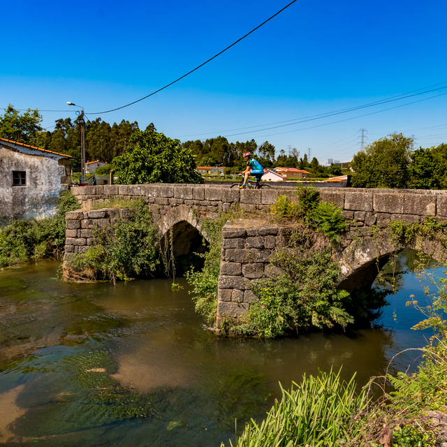
It is a course directed to practitioners with experience, with good technical ability and good physical resistance, where the floor is very variable and there are many technical passages. The red trail leaves the mountain bike center together with the green and A blue trail, goes along trails beside the Ferreira river and then goes around the Santa Justa mountain range on the south side and starts to climb up to the geodesic mark at 369 m altitude. From here it starts to descend through: Santa Justa chapel, former sanatorium and Srª do Chão chapel. Then it crosses Valongo to the North, passes the chapel of São Bartolomeu, and then goes up to the Quintarei geodesic landmark. It descends again until it meets the B blue trail and crosses the whole valley. It separates from this one to the south of Sobrado to go up to the top of Borbulhão and then down to Valongo. It crosses the urban centre until it reaches the beginning / end point.
Distance: 30,7 km
Time: 3h to 4h
Climbing: 904 m
| p4 blue |
This course is intended for practitioners with little experience, little technique and normal physical stamina in which the floor has to be firm or stable. This course starts at the second entrance of the Valongo MTB Center in Sobrado, near the Indoor Soccer pavilion. It runs through the north-western part of the Sobrado, between cultivation areas and mostly through forest areas. It follows mostly dirt roads that are almost always at the same level, going down slightly in the extreme north and then back up. It returns to the Sobrado from the west, entering the urban area from the south, thus returning to the starting point.
Distance: 12,5 km
Time: 1h30 to 2h00
Climbing: 335 m
| p5 red |
This course is aimed at experienced practitioners, with good technical ability and good physical resistance, where the floor is very variable and there are many technical passages. This trail starts in Sobrado and goes along with the blue course. In the most northeastern part of the blue trail, the red trail separates and goes up to the Quintarei geodesic mark. Following the top of Saldanha, with a view over Valongo, it goes up to the top of Borbulhão and from here down to Valongo. Passing in the urban center and near the entrance door. From here you follow paths and trails by the Ferreira river, you will cross the bridge over the Ferreira river in Couce and go up to the Pias hills. From this point you will descend and continue towards Sobrado, passing by the church of São Martinho do Campo and the Roman bridge over the Ferreira river and then you will continue towards Quinta das Arcas. Reversing to the north, the trail passes still in the Parish Church of Sobrado before reaching the final point together with the blue trail.
Distance: 35,6 km
Time: 2h to 3h
Climbing: 1060 m
| p6 black |
This course is recommended for practitioners with a lot of experience and high physical stamina, very technical course and with all kinds of trails. The black trail leaves the MTB Center to the west, passing over the Ferreira river where you can see the Arcos aqueduct. It passes behind the quarry where the slates of Valongo are produced, to go up a bit to the Serra de Pias and down towards Sobrado. Passing by the church of São Martinho do Campo and the Roman bridge over the Ferreira river, you continue towards the farm of Arcas. Turning north you will cross the A41 and A42, entering forest areas. It crosses the A42 again and then joins the red B and blue B routes. Climb to the top of Quintarei, follow the Alto do Saldanha and at the top of Borbulhão descends to the urban area of Valongo. Passing near the mountain bike center and joining the green, blue A and red A courses, it now starts the loop through the Santa Justa mountain range. Here it passes by the geodesic mark (369 m), the chapel of Santa Justa, and then descends to the urban center of Valongo, arriving this way to the Mountain Bike Center.
Distance: 49 km
Time: 3h to 4h
Climbing: 1405 m
gallery
institutional partners


FPC contacts
- Rua de Campolide, 237
1070-030 Lisboa - (+351) 213 802 140
- This email address is being protected from spambots. You need JavaScript enabled to view it.